No Products in the Cart
Call Us: +1 866 300 9012
contact@measur.ca| Working Time Up To | Internal Radio |
Channels |
Ingress Protection |
22 Hours |
LoRa Technology
|
184
|
IP67
|
Gets a Fix in SecondsReach RS2+ gets a fixed solution in just seconds and maintains robust performance even in challenging conditions. Centimeter accuracy can be achieved on distances up to 60 km in RTK, and 100 km in PPK mode.
|
PPP SupportRINEX raw data logs are compatible with PPP services so you can now get centimeter-precise results in any place on Earth. Process RINEX files in an online service and get position with absolute accuracy regardless of your location.
|
Built-In 3.5G ModemReach RS2 features a power-efficient 3.5G HSPA modem with 2G fallback and global coverage. Now corrections can be accessed or broadcasted over NTRIP independently, without relying on an Internet connection on your phone. |
22 Hours On One ChargeUp to 22 hours of autonomous work when logging data and up to 16 hours as a 3G rover, even in cold weather—no more need to carry spare batteries with you. Reach RS2 can charge from a USB wall charger or a power bank over USB-C. |
868/915 MHzFrequency Range |
Up to 8 kmAt only 100mW |
300% more rangeCompared with FSK radios at the same power |
LoRa Spread Spectrum modulation can work on distances up to 4 times longer compared with traditional FSK radios at the same power output. This gives Reach RS2 robust radio performance without sacrificing battery life. LoRa radio is used to connect rover to base when Internet-delivered corrections are not available.
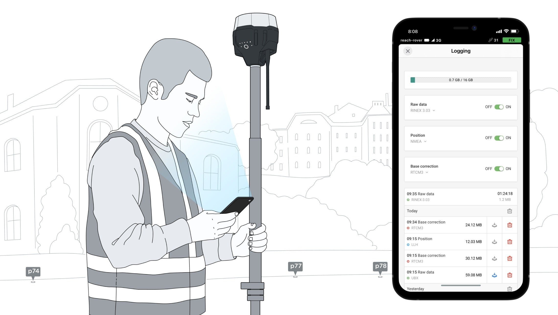
With ReachView 3, you can collect and stake out points and control all the features of Reach receivers, such as setting up a base station, logging RINEX data, and configuring NMEA output. The app is available both for Android and iOS, supports thousands of coordinate systems and is translated into multiple languages.

Coordinate systems based on WGS84, NAD83, GDA2020, and others